
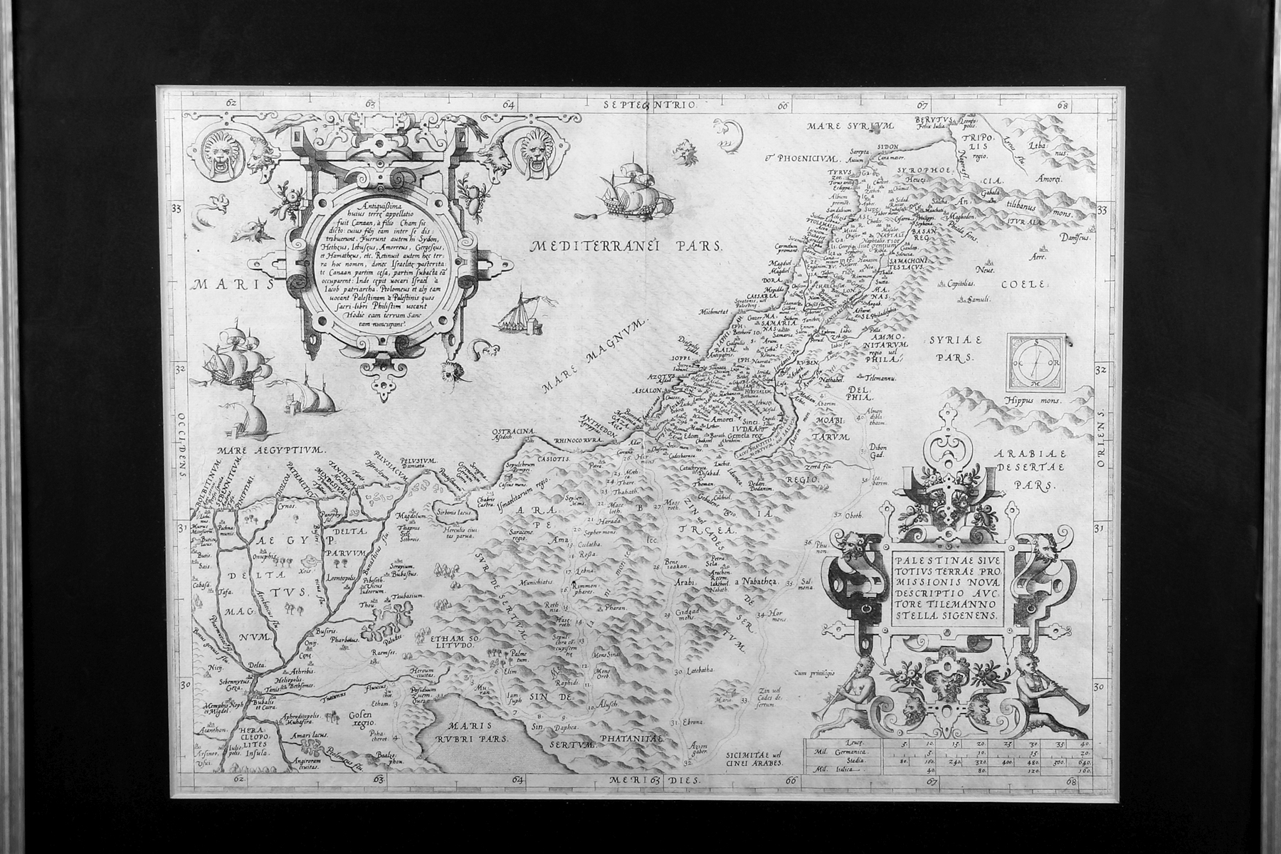
Auction 24 · Lot 275
Ortelius, Abraham. Palestinae sive totius Terrae Promissionis nova descriptio, auctore Tilemanno Stella Sigenens [A new description of Palestine or the whole Promised Land]
- Estimate
- $500–$700
- Hammer price
- $1,100
Historical auction record. Hammer prices exclude buyer’s premium and taxes.
author
(MAP OF HOLY LAND)
printer
A. Coppen van Diest
Place
(Antwerp
Publication
1570-71)
Description
FIRST EDITION. Copperplate. Latin. On verso “Palestina vel Terra Sancta”
references
Laor 539
summary
This map is taken from p. 51 of the first edition of Ortelius’ atlas Theatrum Orbis Terrarum.
The cartouche in the upper left corner informs us that in antiquity the land was called ”Canaan” after the son of Ham by that name.
Abraham Ortelius, the Flemish scholar and geographer (1527-1598), has been referred to as the “Father of Modern Cartography.” His atlas, considered the first true atlas, went through five major editions between 1570 and 1603, and was produced in Latin, German, French, and Dutch. It is fair to say that Ortelius’ endeavor contributed to the shift of the mapmaking industry from Italy to Antwerp. The original 1570 Latin edition of the Theatrum consisted of 70 maps on 53 sheets with accompanying texts. See Marcel P.R. van den Broecke, Ortelius Atlas Maps: An Illustrated Guide (Netherlands, 1996), pp. 39-289; Peter H. Meurer, Fontes cartographici orteliani: Das “Theatrum orbis terrarum” von Abraham Ortelius und seine Kartenquellen (Weinheim, 1991), pp. 10-11
350 x 460 mm. Not examined out of frame
Enquire about this lot