
Auction 33 · Lot 123
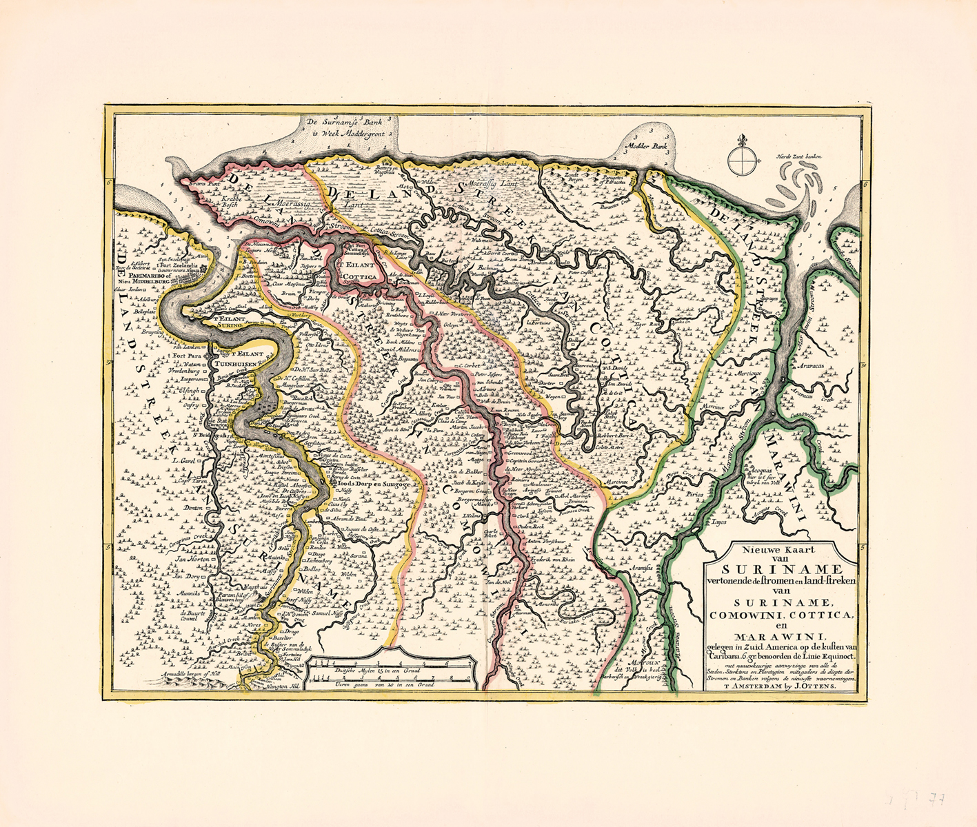
Nieuwe Kaart van Suriname vertonende de stromen en land-streken van Suriname, Comowini, Cottica, en Marawini [“New Map of Surinam Showing Streams and Stretches of Land of Surinam, Comowini, Cottica, and Marawini.”]
- Estimate
- $3,000–$4,000
- Hammer price
- $3,000
Historical auction record. Hammer prices exclude buyer’s premium and taxes.
author
(SURINAM).
printer
J. Ottens
Place
Amsterdam
Publication
before 1718
Description
map, handcolored in red, yellow and green
references
Ir. C. Koeman, Bibliography of Printed Maps of Suriname 1671-1971, no. 6; EJ, Vol. XV, col. 530 (commemorative stamp of Surinam showing detail of similar, but not identical map)
summary
This map, published by the well-known mapseller Josua Ottens of Amsterdam, was presumably based on Mogge’s map of 1671, the oldest known printed map of Suriname. In our map, great prominence is given to the “Joods Dorp en Sinagoge” [Jew’s Town and Synagogue] as well as to several Jewish-owned plantations in that immediate vicinity. Thus, we find an abundance of Spanish-Portuguese Jewish names: de Fonseca, de Pina, Serfatyn, Nunes da Costa, Barug de Costa, Nassy, Elias Ely, de Silva, Abram de Pina, Jacques da Costa, Benjamin da Costa, Parera, Josue and Jacob Nassy, Rafael Aboafe, Nunes, Isaque Pereira, Montesinus, M. Nassy, S. Nassy, Samuel Nassy.
This may very well be the first mention of a synagogue in a map of the Americas
390 x 500 mm
Enquire about this lot